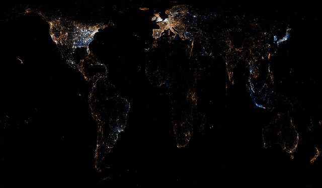
Remember those light pollution—err… I mean those Earth at Night—maps that were so popular in the late 1990s? Well, it’s time to move on. Eric Fischer, Google programmer and digital map aficionado, has created something that will delight even the techiest of tech-lovers. Bye bye city lights, hello geotagged tweets and Flickr photos.
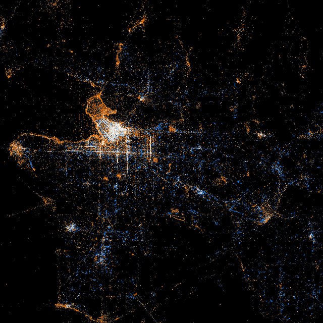
Red dots are locations of Flickr pictures, blue dots are locations of Twitter tweets and white dots are both. Click the maps to zoom in.
World Map

What’s Cool: The Galapagos Islands Flickr cluster, tweets from what appears to be an Antarctic Research station (directly south of Cape Town)
Vancouver

What’s Cool: The Capilano Suspension Bridge/Cleveland Dam/Grouse Mountain Flickr trail, the mallard-head outline of Stanley Park (coincidence, or are the ducks smarter than we think?)
New York

What’s Cool: Central Park (does nature distract from tweeting?), the Staten Island Ferry Flickr route, Yankee Stadium, JFK Airport
Check out more in Eric Fischer’s Flickr set, See Something Say Something.


